How to install Esri ArcGIS Desktop 10.7 on your computer?
Esri ArcGIS Desktop is a powerful GIS software that allows you to create, analyze, and share maps and data. In this tutorial, we will walk you through the steps to install ArcGIS Desktop on your computer.
Step 1: Download the installer
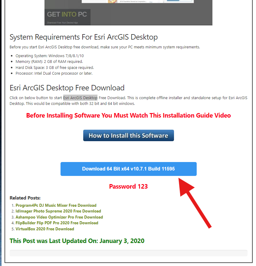
- Click this here (opens in a new tab) and scroll down to get the download link as shown in this image for the ArcGIS Desktop installer.
- This will redirect and take some time to download.
Step 2: Turn off your Antivirus software
- Follow tutorial from this link (opens in a new tab) to turn off your antivirus software.
- You don't need any other antivirus software. Windows Defender is enough.
This is very important step. If you don't turn off your antivirus software, it will delete the crack files.
Step 3: Extract the zip file
- Right click the downloaded file and select
Extract Hereto extract the contents of the zip file. - You will be prompted to enter password. The password is
123.
If you like, here is a video tutorial explaining the whole installation process. Video tutorial (opens in a new tab)
Step 4: Run the setup
- Open the extracted folder and run the setup file.
- Follow the on-screen instructions to install ArcGIS Desktop on your computer.
Step 5: Crack the software
- After installation, go to the extracted folder and open crack folder.
- Copy the files in the crack folder and paste them into the installation directory.
You might want to add the crack files to your antivirus exclusion list to prevent them from being deleted.
How to add file exclusions in Windows Security / Windows Defender
- Open Windows Security / Windows Defender
- Click on Virus & threat protection
- Click on Manage settings
- Scroll down to Exclusions and click on Add or remove exclusions
- Click on Add an exclusion and select Folder
- Browse the folder to exclusion
If you like, here is a video tutorial (opens in a new tab) on how to add any file exclusions in Windows Defender.
Hurray! You have successfully installed Esri ArcGIS Desktop on your computer. You can now start creating, analyzing, and sharing maps and data using this powerful GIS software.
What is ArcGIS Desktop?
ArcGIS Desktop is a suite of applications that includes ArcMap, ArcCatalog, and ArcScene. It offers advanced GIS capabilities for analyzing geographic data, creating maps, and managing spatial information. ArcGIS Desktop is designed for users who need desktop-level control over their geographic data while leveraging the power of Esri's GIS platform.
While ArcGIS Pro is the newer, more modern version, ArcGIS Desktop (primarily ArcMap) remains widely used in industries and organizations that require a stable and robust GIS tool. ArcGIS Desktop enables users to manage spatial data, create detailed maps, and perform powerful spatial analysis tasks.
Key Features of ArcGIS Desktop
1. Robust Mapping and Cartography
ArcGIS Desktop is known for its high-quality cartographic capabilities. It offers a wide array of tools for map creation, allowing users to design and produce professional, print-ready maps with advanced symbology, labeling, and layout features. The intuitive interface makes it easy to create maps that convey complex spatial information clearly and effectively.
2. Spatial Analysis and Geoprocessing
With a broad selection of geoprocessing tools, ArcGIS Desktop allows users to perform sophisticated spatial analysis. Whether you're running spatial queries, performing network analysis, or creating models for suitability analysis, ArcGIS Desktop provides everything needed for in-depth analysis of geographic data.
Key analysis tools include:
- Buffering
- Overlay analysis
- Surface analysis
- Hydrologic modeling
3. Data Management and Editing
ArcGIS Desktop provides comprehensive tools for data management, including support for multiple formats such as shapefiles, File Geodatabases, and Raster datasets. You can easily edit and update spatial data, whether you're working with vector or raster data. The integration with enterprise geodatabases and versioning makes ArcGIS Desktop an ideal choice for managing complex datasets in multi-user environments.
4. Geospatial Data Integration
ArcGIS Desktop supports a wide range of data formats and integrates with various data sources, including databases, CAD files, and web services. This flexibility makes it easy to work with diverse data types and combine them for more detailed analysis. Users can also access and work with ArcGIS Online and ArcGIS Server services directly within ArcGIS Desktop for enhanced functionality.
5. Customizable and Extendable
ArcGIS Desktop offers a high level of customization through the use of Python scripting and ModelBuilder, allowing users to automate repetitive tasks and create custom workflows. For more advanced users, ArcObjects provides a software development kit (SDK) for creating custom GIS applications and extending the functionality of ArcGIS Desktop.
6. 3D Visualization with ArcScene
While ArcGIS Desktop is primarily a 2D GIS platform, it offers 3D capabilities through ArcScene, a tool for visualizing and analyzing 3D data. Whether you're working with terrain models, cityscapes, or subsurface data, ArcScene allows you to view and analyze your data in three dimensions, providing a more comprehensive understanding of spatial relationships.
7. Map Sharing and Collaboration
ArcGIS Desktop provides the ability to create web maps and web apps that can be shared with colleagues or the public via ArcGIS Online or ArcGIS Server. This makes collaboration easy, as teams can access the same maps and data remotely, enhancing decision-making and workflow efficiency.
8. Support for Multiple Platforms
ArcGIS Desktop is compatible with multiple operating systems, including Windows 10 and Windows Server environments, ensuring it can be deployed in a variety of enterprise setups. Additionally, ArcGIS Desktop integrates smoothly with other Esri products, such as ArcGIS Enterprise and ArcGIS Online, for seamless cross-platform workflows.
Why Choose ArcGIS Desktop?
1. Comprehensive GIS Tools
ArcGIS Desktop is a well-rounded GIS solution with powerful capabilities for map creation, spatial analysis, and data management. The broad range of geoprocessing tools, advanced cartography options, and data editing features make it an ideal choice for professionals who require a full-featured GIS software package.
2. Proven Reliability
With decades of development, ArcGIS Desktop has been a trusted GIS solution for organizations worldwide. Its stability and reliability make it a go-to tool for critical GIS tasks. Users can rely on ArcGIS Desktop to handle complex geospatial projects, even with large datasets and intricate spatial models.
3. Industry-Specific Applications
ArcGIS Desktop is widely used across industries such as urban planning, transportation, environmental management, and public health. Its flexibility and extensibility make it suitable for a variety of sectors, and Esri offers specialized tools and templates for various industry needs, ensuring that users can get the most out of their data.
4. Broad User Community
As one of the most widely used GIS platforms, ArcGIS Desktop has a large and active user community. This extensive user base means that there is a wealth of tutorials, forums, and documentation available to help users resolve issues and improve their skills. Users can also access Esri's technical support and training resources to ensure they are getting the most out of the software.
5. Integration with Esri's ArcGIS Platform
ArcGIS Desktop integrates seamlessly with other products within the ArcGIS platform, including ArcGIS Online for cloud-based mapping, ArcGIS Server for web services, and ArcGIS Enterprise for large-scale, enterprise-level GIS solutions. This interconnectedness ensures that users can work across various Esri products to enhance their GIS workflows.
Conclusion
ArcGIS Desktop is an industry-standard GIS software that continues to serve professionals in various sectors. Whether you're creating detailed maps, performing spatial analysis, or managing large datasets, ArcGIS Desktop provides the tools needed to tackle complex geospatial challenges. Despite the rise of ArcGIS Pro, ArcGIS Desktop remains a reliable and powerful GIS solution for users who need a comprehensive, stable, and user-friendly platform for their GIS needs.
With its robust suite of tools, customizability, and integration with other Esri products, ArcGIS Desktop remains an essential tool for GIS professionals worldwide.
For more information about ArcGIS Desktop, visit the official Esri website (opens in a new tab).